Nettetal: Galgenvenn
Circular walk, 10 km
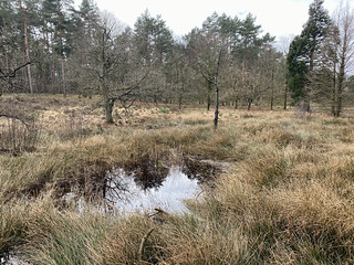
Walk through the Maas-Swalm-Nette border park. You start this walk at the Galgenvenn. You walk through a peat area with countless fens. You walk through the Brachter Wald to the Holtmühle nature reserve on the Dutch side of the border. On a hilly path you follow the high terrace of the Maas and then descend to the middle terrace. With a forest path you return to the Galgenvenn.
- shape
- loop
- length
- 9 km 901
- location
- North Rhine-Westphalia, Germany
- start / arrival
- Waldgasthaus Galgenvenn, Knorrstraße 77, Nettetal
- path
- path:98% road:2%
- elevation
-
rise: 173m / fall: -173m
lowest: 30m / highest: 76m

photo 1 of 8
Follow route
Route "Nettetal: Galgenvenn" is recorded on 17th March 2021 and placed on 21st March 2021. The route has been viewed 4650 times.
Online
The route has been followed 3 times online. You can follow the route yourself online with the application on this page. You start the application by pressing the button below this text.
First read the user manual
Download GPX
The route has been downloaded 55 times. You can download the route file (gpx format) yourself using the button below this text and use it to follow the route with a navigation device that works on the basis of the Global Positioning System (GPS).
Points of interest
- Haus Galgenvenn, Knorrstraße, Nettetal
Tap point to show / hide it on the map.